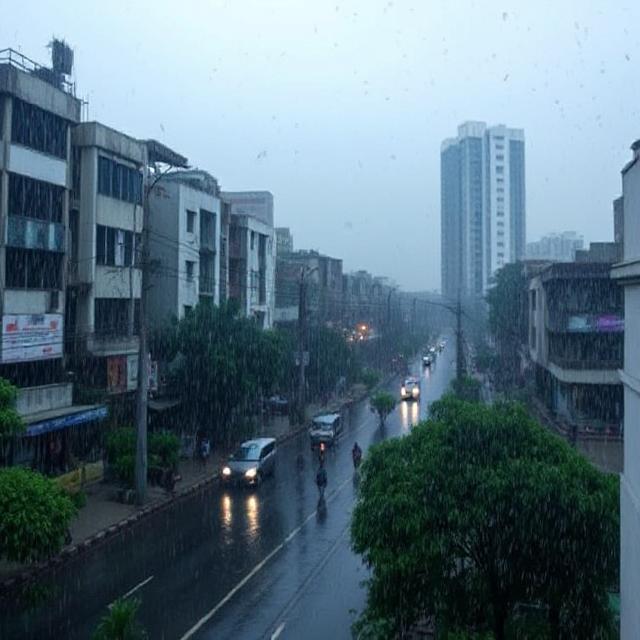
Kolkata is bracing for intense weather activity as the India Meteorological Department (IMD) has issued an orange alert for heavy rainfall and Kalbaishakhi storms over the next 48 hours. A cyclonic circulation over the region is expected to trigger widespread showers, strong winds, and potential disruptions.
Current Weather Situation in Kolkata
- IMD Alert Level: Orange (Be Prepared)
- Expected Rainfall: 100-150 mm in 24 hours
- Wind Speed: 50-60 km/h (Gusts up to 70 km/h)
- Affected Areas: Kolkata, Howrah, Hooghly, South & North 24 Parganas
Key Weather Systems Driving the Rain:
✔ Cyclonic Circulation over Bangladesh & adjoining West Bengal
✔ Moisture inflow from the Bay of Bengal
✔ Kalbaishakhi (Nor’westers) – Pre-monsoon thunderstorms
Kolkata Weather Forecast (Next 5 Days)
| Date | Weather | Rainfall | Temperature |
|---|---|---|---|
| Today | Heavy Rain + Thunderstorm | 100-150 mm | 28°C – 33°C |
| Tomorrow | Moderate to Heavy Showers | 50-100 mm | 27°C – 32°C |
| Day 3 | Scattered Rain | 20-50 mm | 28°C – 34°C |
| Day 4 | Partly Cloudy | Isolated Drizzles | 29°C – 35°C |
| Day 5 | Sunny Intervals | No Rain Expected | 30°C – 36°C |
How This Compares to Previous Kolkata Weather Events
| Parameter | Current Alert (May 2024) | May 2023 Storm | Typical May Weather |
|---|---|---|---|
| Rainfall Intensity | Heavy (100-150 mm) | Extreme (200+ mm) | Moderate (50-80 mm) |
| Wind Speed | 50-60 km/h | 80-90 km/h | 20-30 km/h |
| Duration | 2-3 days | 1 day | Short bursts |
| Disruptions | Localized flooding likely | Major flooding | Minor waterlogging |
Potential Impacts & Safety Precautions
⚠ Expected Disruptions:
- Waterlogging in low-lying areas (Park Street, Behala, Salt Lake)
- Delayed flights/trains due to reduced visibility
- Possible power outages in storm-affected zones
✅ Safety Tips for Residents:
✔ Avoid unnecessary travel during peak storm hours (afternoon/evening)
✔ Secure loose objects on balconies to prevent wind damage
✔ Keep emergency lights, chargers, and drinking water stocked
✔ Monitor IMD updates via @Indiametdept (Twitter)
Why Is Kolkata Experiencing Severe Kalbaishakhi Storms?
The combination of high humidity, rising temperatures, and cyclonic circulation is fueling these intense pre-monsoon thunderstorms. Historically, May sees the highest frequency of Kalbaishakhi activity in West Bengal.
Long-Term Forecast: Will the Rains Continue?
- Short-Term: Heavy rains likely till [insert date], gradual reduction afterward.
- Monsoon Outlook: Southwest monsoon expected to hit Kolkata by June 10-15, 2024 (normal onset).
Final Advisory for Kolkata Residents
The IMD’s orange alert indicates significant but not extreme weather. While the city is accustomed to May storms, precautions are advised—especially in flood-prone zones. Stay updated via official sources and avoid rumor-mongering on social media.
🔔 Follow for Real-Time Updates:
- IMD Website: https://mausam.imd.gov.in
- Kolkata Municipal Corporation Helpline: 1070